Sunday, 19 January 2014

Third Month in Zihuatanejo, Solar System

Time flies when you're having fun! We have been here two months as of the 17th. We haven't done a lot; Dog walks daily but not too far, dinner and lunch out frequently, breakfast out at La Bocana yesterday--very nice--visiting with friends.. . . .

Art began investigating why the solar system isn't working as it should--it really doesn't get the batteries up to full like they should (14.4 Volts). Essentially the problem is the location of the charge controller--much too far away from the batteries. A major upgrade in wire size would help but not enough and it would not be an easy job.

The design and layout of the motorhome and the battery location make it difficult. Art has been on RV.NET getting advice and suggestions from many knowledgeable people, getting ready for a project when we get home!


The 2 80 Watt panels are in the middle. The ones at each end are identical just look different due to the camera lens.


Side view showing location of the solar panels.  The wires go down alongside the waste tank vent, the white tube at the edge of the roof about the middle of the two panels.


They then run down behind the galley wall to the controller, the black panel with the red light showing,  middle of the left edge of the photo.  (above)


 The output wires go down the wall to the floor and join the large wires from the battery at a connection under the stove which also feed the 12V breakers in the cupboard above the micro/convection oven.  (left and below)


These large wires then travel by some unknown route to the battery and electrical compartments on the other side of the motorhome which are to the rear, behind the rear axle and under the bedroom slide.  ( Roughly marked by the white plastic box on the floor down the hall in galley photo above. )


These are the battery and electrical compartments. The stuff on the ground belongs in there too, except for the large white bottle of distilled water.  I'm not sure where we can mount the controller.


This photo shows where the front solar panels are (top left) and where the battery and electrical compartments are. By rights the controller should be in there. Somewhere.

And just to round out the electrical stuff here are pics of the Solar Controller and the Xantrex Remote. :


Friday, 13 December 2013

Some photos for your information and your viewing pleasure. A mixture of tech and nature.

Due to shade of the trees and the building behind us I had to take the panel in the foreground off its mounting bracket and turn it 90 degrees. The two in the middle are 80 Watts each, the end ones 130Watts each.  They are a bit distorted by the camera lens. 

The solar supplies all our12 volt need, lights, fridge control board, water pump etc. Also when the power goes off (frequently due to too low voltage during the day and too high (over 132V) during the evening and night, keeps the batteries up so that we can run the 120 volt stuff from the inverter. We resort to the battery charger part of the inverter (Xantrex Prosine 2.0 ) perhaps once a week to give the batteries a good high voltage (14.8v) charge. 


Sunday, 1 December 2013

17 November Pátzcuaro to Zihuatanejo

Sunday About five hours today, no stops until Zihua so we made sure the dogs got a good stroll, the snack pack had the requisite apples, water bottles were full and we set off at 10:20

We know this area quite well so rather than return to the toll road directly by backtracking or going through (or around) Pátzcuaro to the toll road we proceeded north through the lakeside part of the town on the libre to Uruapan for roughly 20 kilometers then joined the toll road. This part of the libre is very pleasant and quite a pretty drive. Then there is a steep climb to the highway and many Looooong steep downhills.

God forbid a truck loose its brakes here, it is usually several kilometers between runaway lanes. The last one actually leads trucks through a toll booth! Our rig clears the booth with about 5 inches clearance for each mirror, I can't imagine a runaway doing 100 Km/H or more getting through!

Forty five minutes after leaving El Pozo we were on the 37D towards Lázaro Cardenas. About an hour and a half of mostly downhill though not nearly so steep. Fuel use should be better than average! The highway was in surprisingly good shape considering the about of flood damage done to the area during hurricane Manuel. The worst bits were some of the expansion joints on the bridges.

The road had had some emergency repaving done and some of the bridge approaches had washed out.  It will need a proper repair job soon but they did a remarkable job to get the road open. It had been closed for almost a week. 


At 1:35 we paid the last toll at the exit to Zihuatanejo and we were southbound on the 200, about an hour from the town.

There had been a lot of road damage here too, especially the bridges and culverts but repairs were well under way and almost complete.


For the last couple of years there has been a push on the widen and straighten this section of the 200 but of course much of the work has been delayed due to the hurricane.

This bit still needs a little work:


Then we were back on the completed part and arrived in Zihuatanejo a little after 430. We intentionally overshot- our turn by a block in order to fill up with diesel. We just managed to get into the pumps leaving the back end of the jeep on the sidewalk and hopefully enough room to make a U turn back onto the highway.

Traffic was light so we were able to turn into the north bound left lane and easily get over to make the left around the roundabout. At 3:05 we arrived at El Manglar RV Park where the restaurant staff came out to welcome us home.

Odometer: 100641Km,  5,882 Kilometers since leaving three weeks ago to the day. Time flies when you're having fun!     (About 3,675 miles for the metrically challenged.)


Much more to come but that will take another post or two. Just to say we've been here since November 17th!


Saturday, 16 November, Queretaro to Patzcuaro through Morelia.

 Our route today. Queretaro (green pointer top right) south at Salamanca (blue pointer top center) over bridge (red pointer center) to Patzcuaro (green pointer almost off the map).


Quite a nice day again when we woke this morning, about four hours to Patzcuaro.  Since we are already at a Pemex it made sense to fuel up before we left and were on the road at 9:45.

Since we were on the wrong side of a divided highway we had no option but to head north for a bit. There was a returno in the left lane but it was pretty tight and there was a lot of southbound traffic we would have to find a hole in so we trusted ourselves to Mr Garmin and followed the GPS directions to exit to a small town. This led to a roundabout which took us under the highway then a left had us heading south past our last night's stop.

Our route took us through the city watching carefully for signs for the 45D to Salamanca. The GPS and the signs were in agreement once again, we reached the toll booth at 10:45, maybe an hour to our turn south on the 43D to Morelia.

Right on time we left the 45D and paid another toll. Five minutes later on the 43D another toll booth. No payment here, you take a card and pay when you exit. There was a little shop here so we stopped for a pee break for the dogs and Art bought a coffee to keep him awake on the nice straight (mostly) highway.

Then we got behind a group of work trucks, rolling along at some 60 Km/H. They were well over giving an indication that we could pass but we though we'd wait until there was no more oncoming traffic!

 We paid the toll ticket (375 pesos) then were soon on the "new" bridge across Laguna Cuitzeo. The first time we crossed this lake many years ago, before the toll road was built, we had to drive though the old village of Cuitzeo which was not fun! The tightest corners on the narrowest of streets. Would have been impassible with our current rig.

This floating bridge is 6 kilometers long. We just missed getting the sign in the photo.


 Soon we were approaching the city of Morelia, the highway much improved over the years. We recognised most but not all of it. Morelia has a periferico (ring road) that we were supposed to take, starting at the green pointer, top right, and 11 or 12 kilometers counter clockwise around to the blue pointer.


The GPS seemed to be on track, indicating a left turn several kilometers ahead. Since the right lane was full of vehicles and buses leaving and joining the highway we kept to the second of the three lanes Then we realised that we were in the second of four lanes and noted a sign in passing indicating that Trafico Pesado (heavy vehicles) had to turn right and we were not in the right lane. Then the traffic light ahead turned red the right lane was packed full... we had no option. Mr Garmin still said that our right turn was 2. something kilometers ahead. We were at the green pointer above.

Light turned green so we carried straight on hoping that no Transitos (Traffic Police) would notice us! Our right turn came up, we made the turn, traffic was quite heavy but not too bad. The Garmin then indicated a left turn coming up (red pointer):


Several more kilometer in traffic as seen above and below we  finally found ourselves joining a familiar street, the road leading to Patzcuaro. (Blue pointer on the map.) Almost exactly where the perferico exit would have put us.


Whew!

At 2:00 PM we arrived at El Pozo RV Park on the edge of town. There was a wedding party having their photo shoot here when we arrived and we later realised that the reception and party was going on across the street. As Mexican parties go, the music wasn't too loud, at least in comparison the the trains that passed the front gate regularly!

One more day to go!


Odometer: 100340

Saltillo to Matehuala Nov 14, to Queretaro Nov 15

Thursday, November 14, an easy drive some 250 kilometers to the south on what should be good and mostly flat roads. I have no idea what time we woke, but we had lots of time for breakfast, watching the news and walking the dogs before we left the gates behind us at 11:10.

Only one toll on the 57D, 80 pesos for the motorhome and 55 pesos for the jeep towed behind.  Part way along we went through a check point that seemed to be only interested in northbound trucks. This line stretched for well over a kilometer. Glad we were southbound!


We had put the coordinates for the RV Park into the GPS but as we approached we noticed that it wanted us to stay on the main highway which bypassed the city. Knowing better we kept to the right on the nice double laned highway into town. Note to other travellers. The road is pretty good but is has a low speed limit. I don't remember if it was 60 or 40 but there were lots of signs.

Three hours after setting off we stopped just into Matehuala for fuel. Two or three kilometers later we had arrived at Las Palmas Midway Inn

This hotel, really a motel, has a pool, very nice restaurant many small rooms set out like a motel, but only four or five in a row then another group--there are several rows. the property is quite large and spacious, and at the back on oiled gravel is the RV parking area with separate bathroom and showers with hot water. There is also a mile long cycling and walking trail which unfortunately this year showed signs of a lot of dog activity.

Since large rigs can't get through the entrance Art parked the rig in the large forecourt outside the gates and waited for Gillian to register and to get someone to open the gate at the far end.

By 2:35 we had worked our way through the motel units, guided by the gate keeper in a bicycle, and were parked and level. We took on some water here and dumped the holding tanks but didn't bother with electric hook ups. 2 of the three within reach of the extension cord we miss wired. Batteries were fully charged so we would be fine.

Even as we turned in the GPS wanted us to turn round and go back to the bypass! We didn't bother looking to see where it wanted us to go. We suspect (but hadn't checked) the the GPS coordinates were taken at the RV Park area rather than from the entrance and it was trying to get us there via the back roads.   Our SPOT shows where we were. Click on the link and select Satellite (top right) then zoom in as much as you need or wish.

With an earlier start we could have gone straight through to Queretaro, about another five hours, but there was no rush and we were trying to keep Art's headaches to a minimum.

We're not even cooking dinner tonight, not with such a nice restaurant a few minutes walk away.  As last year, the guests in the restaurant appeared to be business people, perhaps business people traveling between Mexico City and Saltillo or Monterrey, or even the US border at Laredo.

The food was quite nice but not as good as we had remembered, but still fine, no complaints.

Odometer: 99701


Friday, 15 November,

We left the park at 9:35, no problem getting across the two north bound lanes to turn south even though there was no traffic light.

  Through town we passed this truck with two enormous pieces of cut stone


then we were soon on the road towards San Luis Potosi and on to Queretaro.  Good road, flat and straight for the most part.


About half way there was our once again one and only toll for the day, only 105 pesos for both vehicles. This time we were charges as a 4 axle truck! Just past the toll booth there was a wide parking area so we took almost an hour for a leisurely lunch and dog stroll.

Note to RVers heading for the trailer park at the Pemex and the Juriquilla Inn:

The exit is very poorly marked and the exit sign cannot be seen until you have actually started the turn! Also the fact that you need to get onto the lateral isn't well marked. So. It's best to stay in the right lane once you cut off from the bypass. You will note many signs for commercial trucks bound for Mexico to take the bypass. You still have several kilometers to go but this stretch can get busy so stay in the right lane.  As you get closer keep an eye out for the Pemex on the other side of the highway.

A soon as you see it take the lateral on your right, this is a two lane one way lateral.

 (IF you miss it  there is another exit, again not very well marked, just ahead that you can take to get on the lateral. The problem is that you need to get right across into the right lane. Don't feel bad if this happens to you. It happened to us last year . . . and again this year!) 

    Ahead you will see two overpasses. The first is a pedestrian overpass, the second is for traffic. You need to slow and turn right IMMEDIATELY you go under the road overpass. The sign is very hard to see. This takes you into a 270 degree turn back over the highway then another right exit and 270 degree turn that puts you northbound on the 57 and the hotel and Pemex is just ahead on the right.  Pull into the parking lot in front and register at the motel office behind you and to your right.

I'd suggest that you walk in and scout out where you want to park before you drive in. Some of the grass is very soft at times:     Scroll down to Queretaro on this blog page

3:30, we had arrived without incident and a pleasant drive though traffic for the last three kilometers had slowed to a crawl due to road works on the centre barrier.  We opted to NOT park on the nice grassy area as we did last time (see link above if you must) and parked in the far back lot. Neither green nor level but nice and firm.

Art's headaches kept recurring, seemingly made worse by driving so we decided to pass on San Juan de Teotihuacan and the Teotihuacan Ruins this time and do it perhaps on the way home in the spring or on the way down again next year. We have visited the ruins twice in the past but never by RV.


Thursday, 28 November 2013

First day in Mexico

Wednesday, 13 November.

I thought I had better date all these entries since they are way behind the posting date!

Art dragged himself out of bed at 6:30, Gillian following soon after. A "quick" breakfast, feed and walk the dogs and we were good to go at 8:00 AM. I should point out that feeding Trekker involves re-hydrating his  dried special liver problem diet.

The Garmin RV GPS didn't seem to think that there was a crossing here suitable to large rigs. It wanted us head northwest to Eagle Pass! A BIG detour! We had made this crossing so knew which way to go and what to expect along the way. We thought.

Our Exit was, according to the sign, 8B, to the Columbia Bridge. There was no 8 A, B etc, just exit 8, signed World Trade Bridge to Mexico. We can't use that one, it's too narrow and congested. However we took the exit to see what we could see as we got higher on the overpass. Then ahead we saw the sign for Solidarity Bridge, which is at the Columbia crossing. Whew! Soon we were back on familiar territory, the Bridge approaches having been changed--and much improved except for the lack of signage.

Over the next 30 kilometers or so Mr Garmin directed us at every opportunity to turn around and proceed to Eagle Pass. Fortunately we long ago realised that voice directions could become very annoying and a real distraction, we had long since muted the voice function.

At 8:30 we arrived at the Solidarity bridge for the Columbia Crossing of the Rio Grande, paid our toll of $7.00 US dollars and at 8:35 we had arrived at Immigration and Vehicle Import.

Even though there was no one in front of us (one couple were leaving as we arrived) it still took 40 minutes to get our 180 day tourist permits, copies of them, pay for them and get and pay for the temporary import permit for the Jeep. The motorhome doesn't need a permit, it has a 10 year permit good until November 2018.

A few minutes after ten we stopped at an OXXO (a chain corner store like the 7-ll) to purchase time on our Mexican sim cards and to fill up Art's travel mug with fresh hot coffee.  He had to wait for a fresh pot to be brewed.  Not a bad thing!

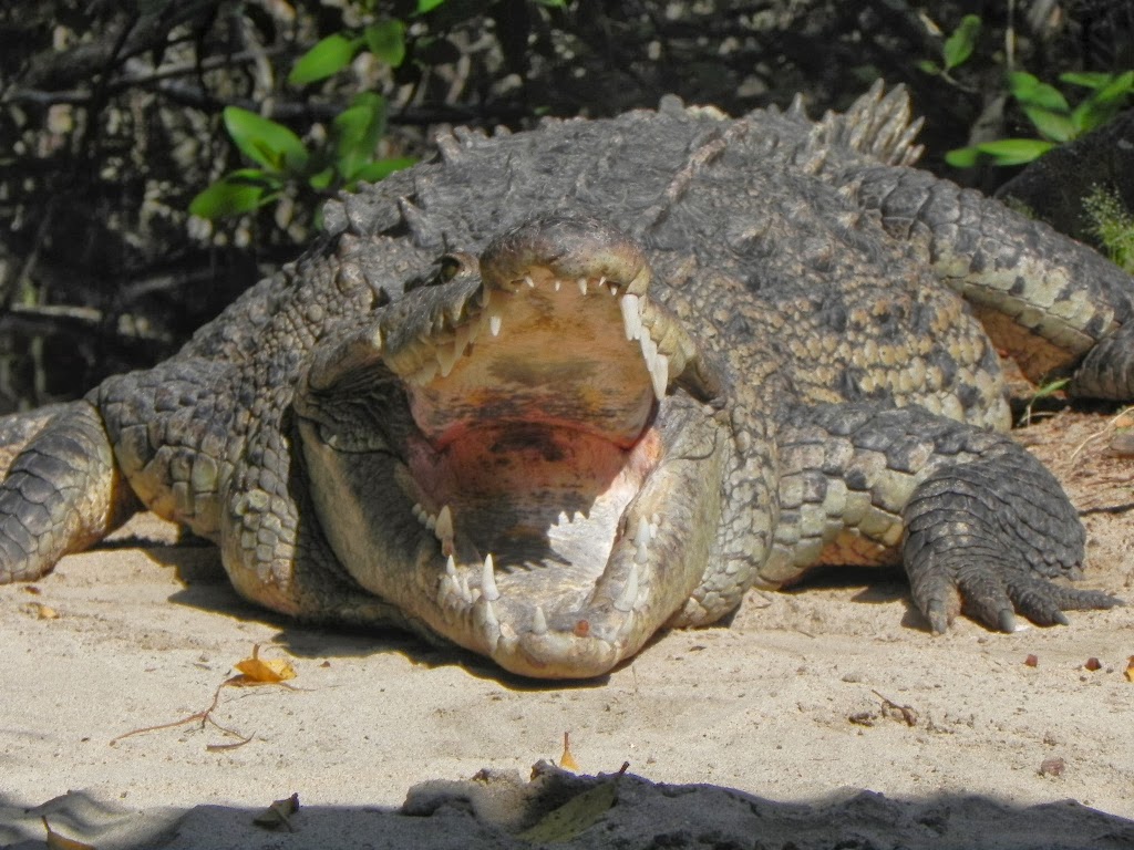
10:20 we are on the road and 2 kilometers later we had to stop at the final check point where customs pulled us aside for a look see.  Painless. No questions about what we were bringing in, our basil, thyme and rosemary plants growing in pots on the dashboard getting only a passing glance. The official, a pleasant young lady, opened a few cupboard doors which of course caused a few thing to fall out to her embarrassment, and we were on the road at 10:35.  Next stop Saltillo.

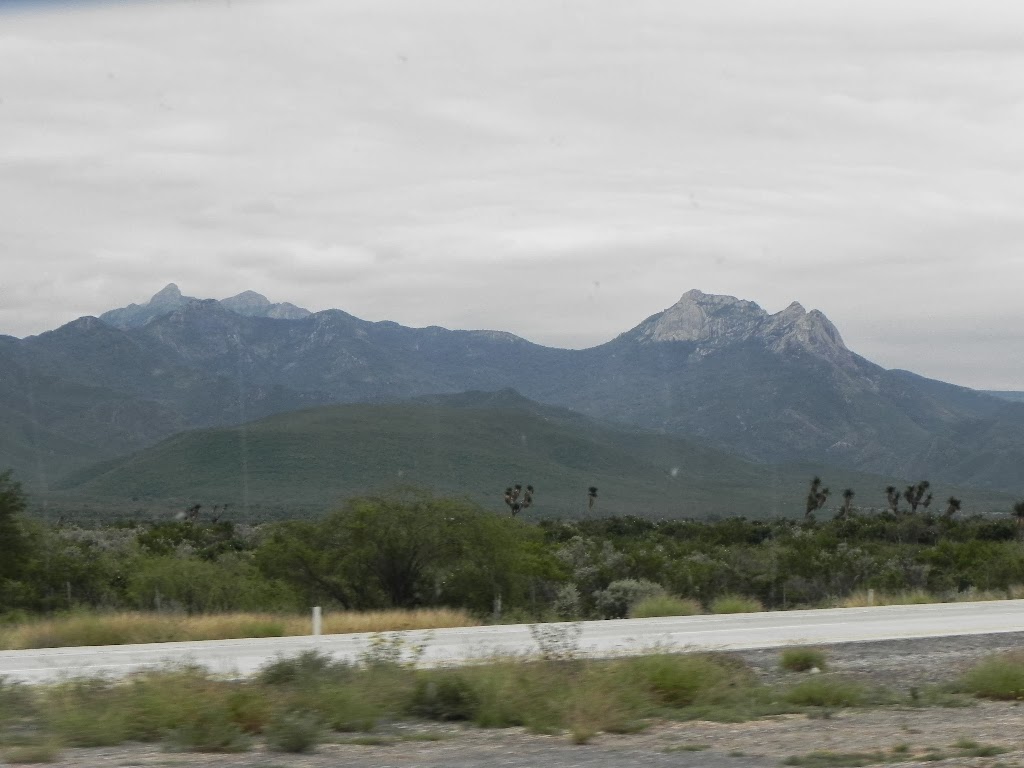
The highway was in pretty good shape, nice driving weather under mostly high cloud, the temperature rising though the morning to the low 20's. Very pleasant.


An hour later we came to the first toll booth when we joined the 85 D to Monterrey; 270 pesos for the motorhome and 205 for the car. Approaching the city we could see the cloud layer dropping. Not looking too good!

Then the periferico around the city; another toll booth at 253 and 130 pesos. As we climbed, the clouds became fog and we had to slowdown, not so much for the grade as for the lack of visibility. Happily all the vehicles had lights on and the 4 way flashers going and were well spaced. NOT the usual tailgating that is so common. Last year the day after we came though here there was a bad multi vehicle accident due to heave fog.

One last toll-- a cheap one, 80 pesos for both vehicles-- put us onto the 40D into Saltillo. Almost there.  We knew that there was a main street that would cut a large corner off and much of the heavy traffic an left turn coming up, but of course we missed it! As it turned out it was a good thing because it joined up with the ring road from the right very close where we had to make a left. It would have meant trying to cross 4 lanes of heavy traffic in about a block!

The GPS seemed to know were we were and we were going but having been to this hotel last year we were not worried. We saw our left exit in lots of time and were able to end up in the right lane after our turn just in time to take the exit to the lateral a few blocks from Hotel La Fuente. Last year we saw the hotel and took the next exit which joins the lateral just past the hotel and we had to make a couple of 'retornos". The GPS wanted us to take that exit (#3) but we knew better and got off at #2.

Art parked on the street for about 5 minutes while Gillian booked us in and made arrangements for someone to open the gate to the vacant lot we were parking on for the night.

This is a very busy and fortunately wide (three lane) lateral as we had to make a wide turn to clear the high curb and to line up for the narrow entrance. When Gillian and a hotel employee showed up a head of him Art got ready to go. He had to wait for a break in the traffic--there was a traffic light a block back--before moving  into the middle lane to make his turn.

As he started his turn from the middle lane two cars came up behind quickly, having just turned onto the road from an alley. One, sensibly moved to the left lane while the other ignored Art's right turn signal and Gillain's frantic waving, began to pass in the right lane. Too bad the motorhome air horns has stopped working but as Art slammed on the brakes the car braked too, swung to the left and passed as he should have and all was well.

We were parked and level by 2:45 Time for lunch! Hotel La Fuente is very nice, well groomed gardens, pool, tennis court etc. RV parking is on a large empty fenced lot often used for truck parking. There are no services, although we believe that there may be low power electric available at one of the lamp standards. Between our solar panels, the generator and the inverter we had no need for electric and our holding tanks were full or empty as appropriate.

We called Jesus and Marta only to find that Jesus was in Torreon some 260 kilometers to the west. Marta however was happy to meet us for dinner later that evening. we went to a small but well known hole-n-the-wall restaurant that specialised in enchiladas. Mmmmmmm good! Marta said that  frequently people are lined up into the street waiting for tables.


Laredo, last day in the USA

Tuesday, 12 November 2013

More than two weeks behind posting blog updates. Oh well, I'll get there eventually.


We were up and about at a reasonable hour, checkout time, noon and it's just a short run to Laredo. where we would spend the night at a Flying J truck stop, a few kilometers from our turnoff to the Columbia Bridge over the Rio Grande.

The morning was taken up with a leisurely breakfast, walking the dogs, emptying the waste tanks and topping up the fresh water. Once taking on Mexican water we would turn off the ice maker and the filtered drinking water at the sink we would be on bottled water for drinking.


We departed Braunig Lake RV Resort at 11:49 Eleven minutes before Check Out time  and turned north for a few miles into San Antonio where we connected via the 410 with the I-35 to Laredo. For the most part we had a more or less following wind, gusty but not too bad, quite a pleasant drive.

Less than 3 hours later we arrive at the Flying J to top up the fuel tanks. It took just a little over 15 gallons, not a lot, but we like to make sure we don't run too low, especially in Mexico. With any luck, we would only need two more fuel stops before Zihuatanejo.

By 2:45 we were parked for the night between a bunch of trucks. The entry to the lot was signed No Commercial VehiclesNo Bob Tails. (Semi trucks without trailers attached.) One of the bobtails  beside us had his loud engine running all night. At least it kept us from being disturbed by the noise of other trucks coming and going!


 One trailer made us smile. Perhaps this explains a lot about Truck Stop Coffee! To be truthful, the coffee at Flying J is quite all right.


Not a lot to do here, we walked the dogs around the perimeter grass a few times, put the satellite dish up and watched the news from home and a program or two had dinner and to bed. Early start in the morning.

Odometer 99079.  4,320 kilometers since leaving home.