A late start today as the air bags were very slow coming up. Being a weekend the Freightliner shop was closed and eventually they filled so we crossed our fingers and set off about 11:30.

Our lunch stop was at the Dawson Peaks Resort in Teslin—this is where the slide motor had failed on the way in. We remembered the the food in the cafe as very good though they had been out of their famous rhubarb pie. This time to Gillian's delight, they had a fresh baked one. After about an hour we set off at again 2:30 with Gillian taking a turn at the wheel for an hour or so while Art had a nap in the co-pilot seat as Trekker kept a sharp eye on the GPS.


 The scenery continued to be very much like what we have been seeing—hills, valleys and water—rivers and streams, lakes and ponds. Always beautiful. Especially when the sun is shining!

At 5:30 we stopped at Watson Lake to look at the thousands of directional and personal signs (and take a picture of AbqL). The signs started during the building of the Alaska Highway when one of the homesick soldiers posted a sign pointing to home. At last count there were 65,000 signs. It's gotten a little out of hand over the years! We spent half an hour here before moving on to BC.

We crossed back and forth between BC and the Yukon, most of the border lines not marked. Finally back in BC we stopped for fuel in Contact Creek, where we had been told was where to buy the least expensive fuel between Whitehorse and Fort Nelson. When asked, the station owner suggested we stopped for the night at a place called Allen's Lookout.


From this vantage point bandits would watch for riverboats loaded with furs or supplies passing up and down the river in order to rob them!
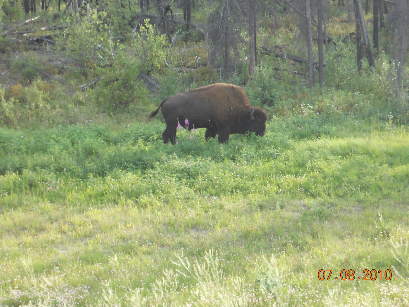
Between Contact Creek and Allen's Lookout we spotted this fellow browsing beside the highway.
We had a good sleep last night, starting off today a little later than we thought we would, rolling down the highway at 9:40


Mid morning we came across a small herd of Wood Bison on both sides of the highway. The few cars on the road stopped for a photo op. Love the old man having a snooze!


A bit later we ran into more bridge construction, then the road, carved from the cliff face, followed the lake for several miles. All makes for an interesting drive.
We pulled off for lunch at 12:15, still 657 kilometres from Mile Zero at Dawson Creek, at least a couple of days away. An hour after getting back on the road we were startled by a loud bang and another sunburst appeared on the windshield.
A bit after 3:00 we turned left off the Alaska Highway to Highway 77 to the North West Territories to Ft Liard, a 140 Km each way detour, just so we could say that we had spent a night in the NWT and earned the right to place another sticker on the map.


For the first 80 or so kilometers the road surface was the best we had seen since we left home, although the bridges were interesting. Just as we were getting complacent they deteriorated a bit—not too bad, until we crossed the BC/NWT border. Now we were on wet gravel at best for the next 40 Km

Eventually we came to the Fort Liard turn off. Turning into the campground the road turned to mud! During the night we heard the rain starting to pour down again, we were having concerns about getting out in the morning.


 This campground is provided and maintained free of charge by the Hamlet of Fort Liard and was quite pleasant in spite of the rain. In sunny weather it would be gorgeous.

Monday, August 9th
We safely navigated the mud in the morning and proceeded into the Hamlet to check our the Visitor's Centre and spend a few $ on souvenirs.


Retracing our steps, this time getting a better pic of the wooden bridge and the river is spanned, we spotted this beaver lodge along the way.

Back on the Alaska Highway we turned south, arriving in Ft Nelson in time for fuel, do some grocery shopping and take a lunch break then moved on.
By 6:30 we had had enough driving for the day so near Pink Mountain we found an area to pull off the road and settled in for the night. Note the satellite dish deployed--All the comforts of home.
Up bright and early next day we were on the road at 8:00. We drove straight through Fort St John except for a detour on an unsuccessful search for a vehicle wash place to rid the rig of days of mud and grime.

Dawson Creek warranted a stop as the official start of Alaska Highway, where we took photos of the Mile 0 signs. We also visited the nearby Visitor's Centre, the Museum, had lunch and found and made good use of a truck wash that had a credit card machine along side the slots for loonies and toonies. $32.00 on the Mastercard and the vehicles were reasonably clean.
Back on the road shortly after 2:00 we crossed the BC Alberta border half an hour later, now truly beginning the eastward part of our journey. 7,960 Kilometers since we left home.
We continued for another 2 ½ hours before stopping for the night at Shreks RV Park in Valleyview, Alberta. We had of course crossed into the Mountain Time Zone and lost an hour. We doubted we would get on the road very early in the morning.


No comments:
Post a Comment